MultiMap
MultiMap is an extensible application to visualize, edit and analyze spatial data on maps.
Maps can be both geographical and non-geographical maps (for example maps created from biological images).
MultiMap desktop application (see section below) was originally created by Gherardo Varando.
MultiMap
For slices layers: ctrl + up arrow or down arrow to increase/decrease the slice level. (Slice level is shown in the bottom left)
Recommended image sources
Full list of neuroimaging repositories:
https://en.wikipedia.org/wiki/List_of_neuroscience_databases
Click on the following sections to view the steps for viewing their images.
Brainmaps.org
Enter in Brainmaps.org
1 - Select a specie on the left sidebar
2 - Select a dataset 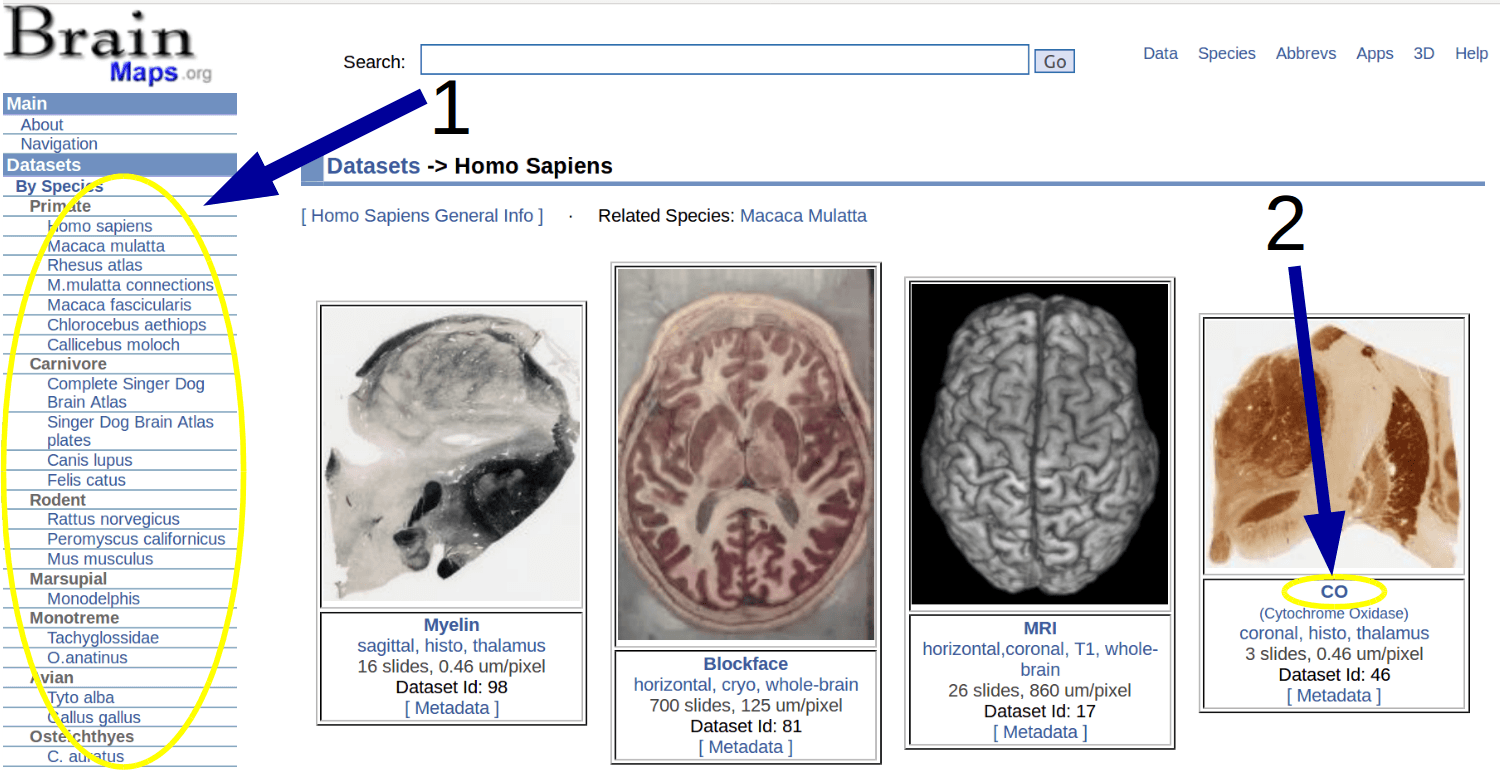
Click on the jpg icon to open the image 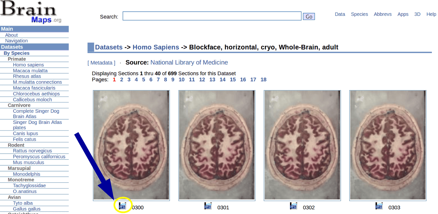
Copy the url from the top of the page

Click the on the "Load image from web button"

Paste the url on the text box 
Allen Institute
Enter in Allen Brain Atlas
1 - Click on the Data button
2 - Select mouse or human brain 
3 - (1) Select ISH data. (2) Select a type of search. (3) Filter the data and obtain the results, click on them. 
4 - While viewing one image, click on the upper right corner. 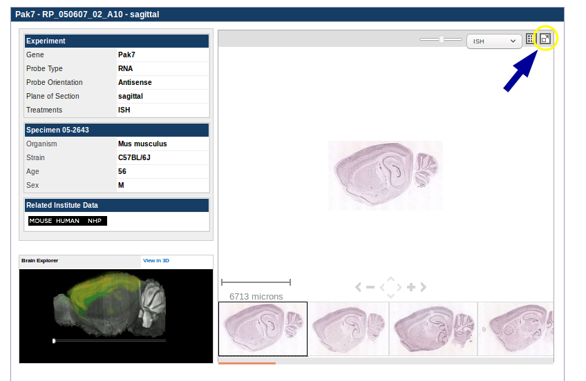
5 - In the new window, click again the upper right corner. 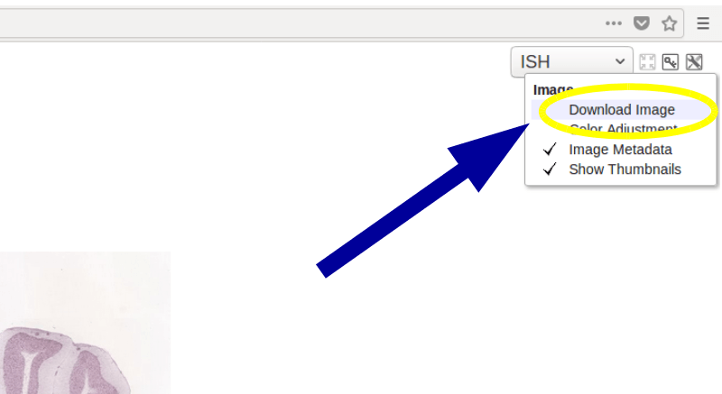
6 - Finally, on the "Download type" select "Entire image", and in the "Downsample factor" select "none". 
Then you can upload the image by clicking the "Load image from your computer" in the "Load Map" button or in the "Load layer" button (if you want to include the image as part of the existing map).
Broad institute
Enter in Broad institute's site and select a dataset 
Click on the download link to download the images from the dataset

Then, in this site, you can upload the image by clicking the "Load image from your computer" in the "Load Map" button or in the "Load layer" button (if you want to include the image as part of the existing map).
Frequent questions
How can I upload my own image?
Click the button and select whatever option you want.
Can I upload images from other websites?
Yes, you can view any image. Furthermore, you don't need to download the images from the internet. You can upload the images by copy and pasting the url of the image.
1 - Copy the url of the image you want to upload
2 - Paste the url on the text box when you click the on the "Load image from web button"

Can I draw figures and include annotations on the map?
Yes, once you have loaded a map, click the icons on the left side to start drawing![]()
To include annotations and change the colour of the figures, click in a figure and click in the icons inside the figure .
.
What are the layers?
A layer is an image or a set of figures. You can upload multiple layers in the same map. In order to do it, first load a map.
Then the button will show up and you can upload another image, that will be another layer. You can activate/deactivate the layers on the upper right corner on the map, clicking the layer
 button.
I loaded my map but I want to include multiple images into it
Review the previous question: "What are the layers?"
I loaded my map but I want to load a new one
Click the button and select whatever option you want
How can I count the number of points in my image?
1 - Click on button
2 - Once the processing is completed, click on the layer button, and select the points layer to view the points:
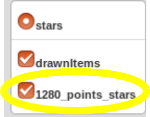 . The first number in the layer's name indicates how many points are in the image.
Why my uploaded images are only available for 1 hour?
In order to mantain our web server disk space we must delete old data
But what can I do to mantain my images for more than 1 hour?
1 - Export your drawing layer (click in "Export map...">"Export drawing layer as JSON")
2 - Upload your image again using the button
3 - Import your existing drawing layer (click in "Load layer..." > "Load drawing layer in JSON") "
"
Load image from computer
Load layer image from computer
Load image from web
Load layer from web
Algorithm points detection options
MultiMap desktop application
We encourage the users to also download our desktop application that provides a rich set of tools to analyze all these kind of maps.
It is also possible to export a map from this web application, modify it in the desktop application and viceversa.
Downloads:https://github.com/ComputationalIntelligenceGroup/MultiMap/releases
Documentation: https://computationalintelligencegroup.github.io/MultiMap-documentation/
Source code repository: https://github.com/ComputationalIntelligenceGroup/MultiMap/
Varando, G., Benavides-Piccione, R., Muñoz, A., Kastanauskaite, A., Bielza, C., Larrañaga, P., & DeFelipe, J. (2018).
MultiMap: A tool to automatically extract and analyze spatial microscopic data from large stacks of confocal microscopy images.
Frontiers in Neuroanatomy, 12, 37. https://www.frontiersin.org/articles/10.3389/fnana.2018.00037
